Decadal Change: Third Mumbai / KSC New Town
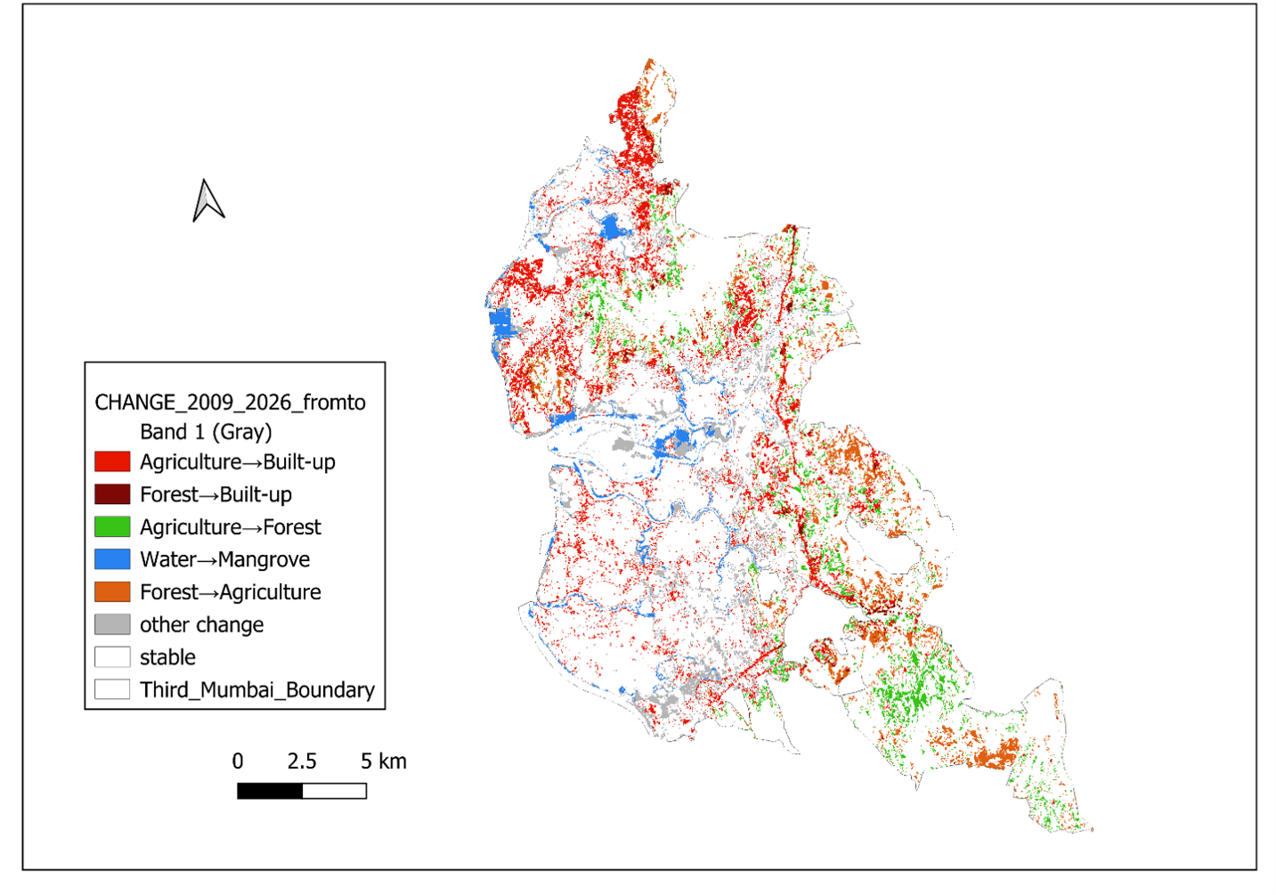
Tracks land-use and ecological change across the Third Mumbai region, a new township announced by the Maharashtra State Government, between 2009 and 2026.
PhD candidate in Rural Development at the Tata Institute of Social Sciences, Tuljapur, working on cultural economies, mountain geographies, gender, and land and forest tenure in the Kumaon Himalayas, alongside a parallel practice in cartography and GIS.
Lavanya's doctoral research examines cultural entrepreneurship and rural regeneration in Munsiyari, a high-altitude town in Uttarakhand's Pithoragarh district on the India–China border. Her thesis draws on geographic and archival methods, combining GIS with historical census records and internet archives to work through questions of cultural landscape and rural definition in the Indian Himalayan context.
She holds a BA and MA in Geography from the University of Lucknow and an M.Phil from TISS Mumbai. Her undergraduate degree paired Geography with Ancient History, an early combination that still shapes her interest in deep-time cultural landscapes. She also designed and taught a QGIS course at the graduate level at TISS.
Beyond the thesis, her cartographic work spans policy-facing thematic mapping, historical spatial narrative, and network analysis, produced for research, publication, and teaching. She serves as Blog Editor and a Co-opted Board Member of the Regional Studies Association, volunteers in building out RSA India's network and activities, and is confirmed eligible for the RSA Fellowship Research Grant Scheme (FeRSA).
Editorial and publishing experience across international academic platforms, from submission screening and reviewer coordination through to production handover.
Research interests, publications, teaching and research experience, service, and training, drawn from her full CV.
BhuPath takes its name from the Sanskrit bhu (earth) and path (path, way). Academic infrastructure, the societies, conferences, journals, and funding that make a research career possible, isn’t equally visible to everyone. Early-career and Global South researchers are often locked out simply because they don’t know where to look, or can’t tell a legitimate opportunity from a dead or predatory one.
BhuPath is a free guide to the infrastructure that’s usually invisible from outside institutional networks, with tools to check whether an unfamiliar venue is worth a researcher’s time before they commit to it. Nothing on it is invented, and no listing goes up without a live link check.
Currently in development and testing ahead of a wider public release.
Version 1, with the open guide and directory, is out and can be accessed here: https://bhupath.vercel.app/
A selection of GIS output built in QGIS, Python and Google Earth Engine, spanning doctoral research, policy-facing publication, historical spatial narrative, and curriculum design for a master's-level GIS course.

Tracks land-use and ecological change across the Third Mumbai region, a new township announced by the Maharashtra State Government, between 2009 and 2026.

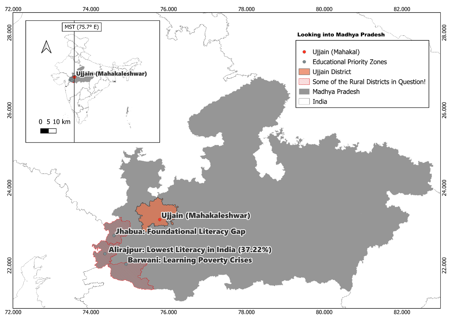
Identifies rural districts in Madhya Pradesh with critical literacy deficits: Alirajpur, India's lowest-literacy district at 37.22%, alongside Jhabua and Barwani as foundational literacy gap zones. Built end-to-end from data collection through to a policy-facing cartographic output for a public audience.

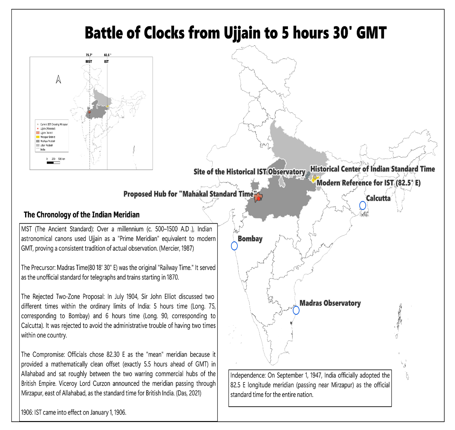
Traces the contested spatial politics of India's meridian: from Ujjain's ancient astronomical role as a prime-meridian equivalent, through the colonial railway-time debates, to the adoption of IST at 82.5°E in 1947. Annotated text panels integrate with the cartography to build a political argument spatially, treating the map as evidence rather than illustration.

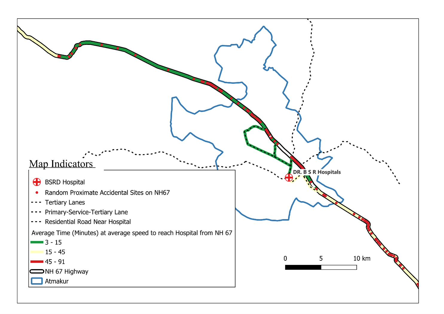
Analyses average travel time from accident sites along National Highway 67 to the nearest hospital, using graduated road symbology across three bands (3–15, 15–45, 45–91 minutes). The most technically demanding piece in the portfolio, applying spatial network analysis with direct implications for emergency-response and infrastructure planning.

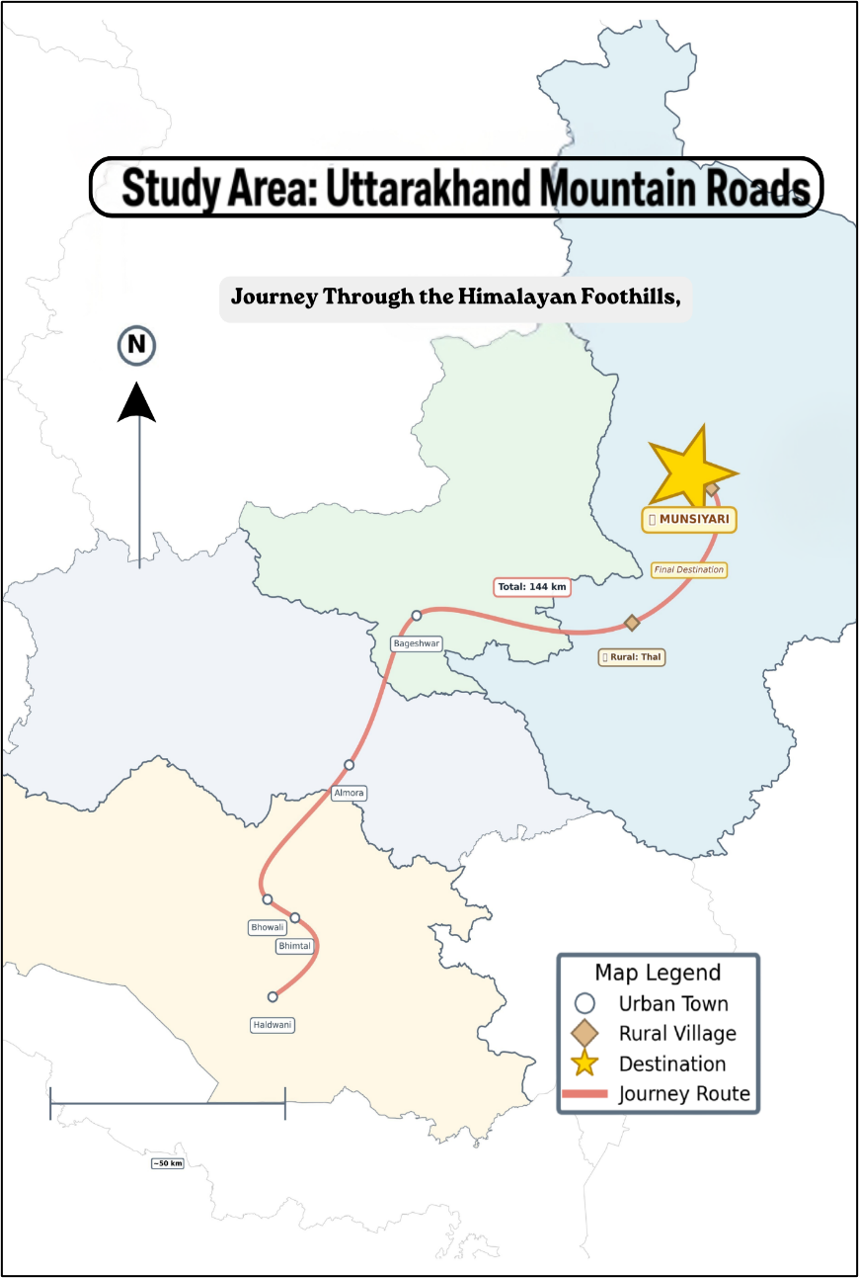
Maps the 144 km fieldwork route from Haldwani through Almora, Bageshwar and Thal to Munsiyari, a high-altitude district on the India–China border, distinguishing urban towns, rural villages and the research destination. The route is indicative of the journey's trajectory rather than drawn to scale.

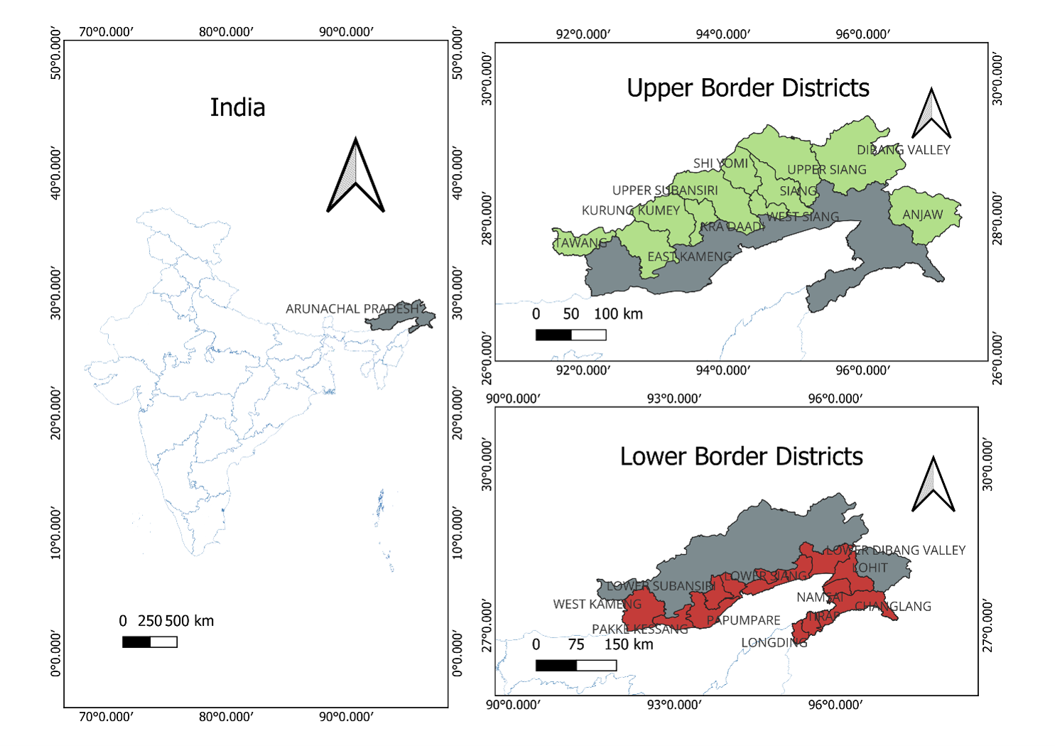
A curriculum map set for a master's-level GIS exam. Three panels separate the upper and lower border districts of Arunachal Pradesh, India's most strategically sensitive northeastern frontier state, with a national locator panel to test students' ability to communicate administrative complexity across multiple scales.

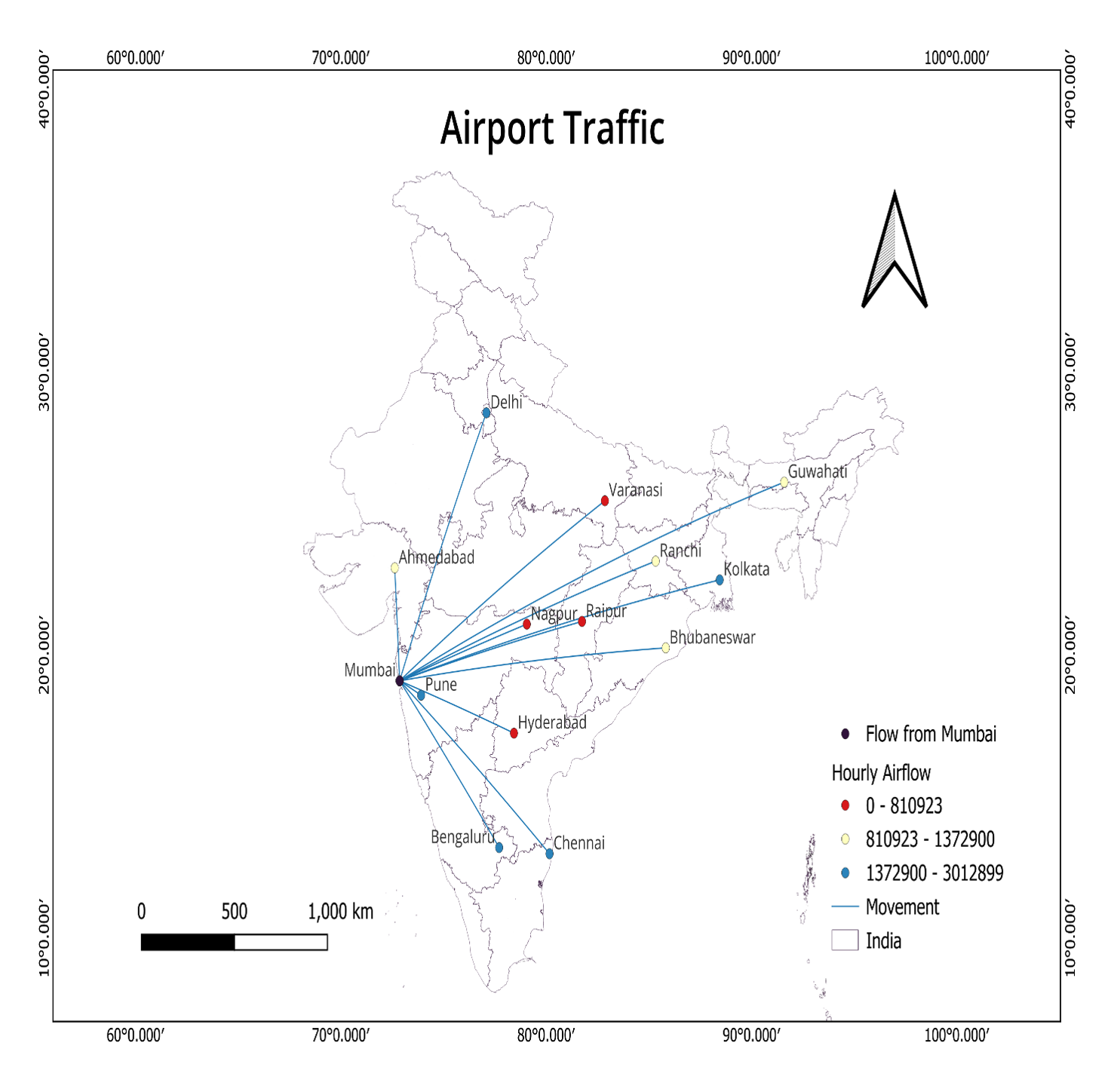
Maps hourly airflow volumes from Mumbai to major Indian cities with directional flow lines and a three-tier graduated point scale for low, medium and high traffic. A dedicated exercise in flow and network mapping, visualising movement, connectivity and spatial hierarchy together at national scale.

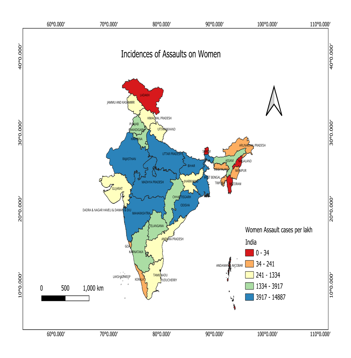
A second curriculum map for the same master's GIS exam, where students were required to identify and correct a mismatched colour ramp. The finished piece is a fully labelled five-class choropleth of assault cases per lakh population by state, with the capitals of high-incidence states marked.